Google Earth overlays for
ALP East Gippsland Policy
(2006 Victorian State election)
During the November 2006 State election, the ALP State Government announced a new East Gippsland forest policy based on the findings of the Steedman and Gooding forest review process. The Government announced that it would protect a 41,000 ha area and claimed that this protection could be offered with no reduction in timber resources.
An analysis of this 41,000 ha by VRN revealed that 2000 has has already been clearfell logged.
(Note that the State government has since announced that it will make some changes to the final reserve system for East Gippsland .)
Click on links to open in Google Earth.
1. 2006 ALP protection map.
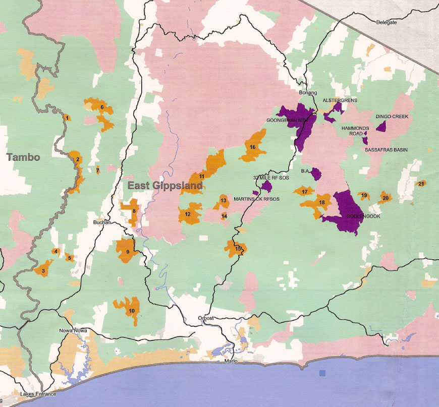
Icon areas (purple on the map below) were in general places that had a history of conflict with the logging industry over the preservation of nature conservation values. They included contentious locations such as Goolengook block and Dingo creek, places that have seen a lot of past protest activity. Old growth areas (orange on map below) were defined as large blocks of forest with minimal of no previous disturbance.
Click on the map below to overlay onto Google Earth.

2. Icon areas:outline of 8 individual areas and 5000ha link (purple)
Note the 5000 ha link will join the Errinundra National Park and Snow River National Park.
3. Old growth areas: The outline of 25 individual the State Governemnt deemed as old growth forest (orange)
4. The Timber Release Plans for 2006 /2007 (2.6 MB). This shows the outline of about 60 logging coups that where scheduled for clearfell logging within the area the Government is committed for protecting.
See a list of all these coupes.
Note: the State government allowed logging to be completed in coupes were logging had commenced before the policy commitment was made in November 2006.
5. Ecologic Vegeitations Maps (EVC maps) for wet forest 3.2MB). These maps are located in the Yalmy area and around the Errinundra National Park. Bright green is wet EVC, cross hatched green other types of damp and dry EVC.
These maps also show logging history:
- Grey is logging up to 2005
- Blue is 1990's logging
- Pink & dark green are logging earlier that 1990's.
6. Informal reserves: The location of SPZ / SMZ that are in close proximity or bounded within the areas the State Government is committed to protecting. (Note: This mapping work has not been completed).
The Victorian Rainforest Network welcomes feedback.
Other useful East Gippsland
Google Earth overlays
Below are more useful layers such as the boundaries of National Parks, location of Rainforest Sites of Significance, logging history, and location of rainforest EVC.
To get these extra layers either:
1. Select "Download all" option to download a single tree place mark![]() .
.
Then click on the ![]() icon within Google Earth to open a pop up box for easy access to all the overlays listed.
icon within Google Earth to open a pop up box for easy access to all the overlays listed.
or
2. Individually download each layer from this table.
East Gippsland |
Colour's |
Webpage background |
|
||
|
||
|
||
|
||
| Downloads a single tree place mark where all above overlays can be accessed within Google Earth. |