East Gippsland Rainforest
On this page:
Rainforest Types
Rainforest Habitat
How much rainforest is threatened by clearfell logging?
Google Earth rainforest overlay for East Gippsland
Rainforest Types
Officially rainforest in East Gippsland covers approximately 9600 ha of the one million hectares of public land. (less than 1%).
There are four 'official' types of rainforest. The two dominate types are Warm temperate rainforest (6967ha or 72% of rainforest) and Cool Temperate Rainforest (2560ha or 26%). The other two are very rare: Cool /Warm overlap (265 ha or 2%) and Dry rainforest.(11 ha or 0.1%)
In addition to the above, Mixed forest (or mixed rainforest) is a rainforest classification where eucalypt forest grows in combination with Cool Temperate rainforest species. The classification of mixed rainforest is controversial as the Victorian Government doesn't officially acknowledge it as rainforest, so it is available for logging.
The following are photos of rainforest within National Rainforest Sites of Significance No. 78.
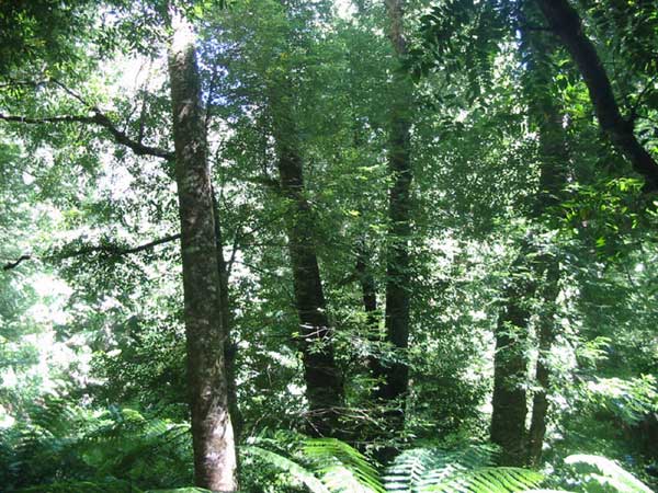
Southern Sassafrass is the primary canopy tree that makes up Cool Temperate Rainforest plant communities in East Gippsland.
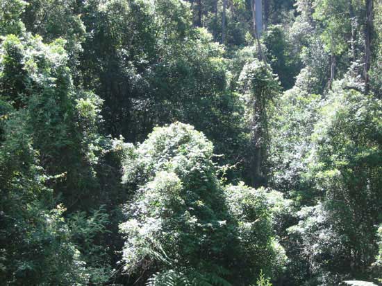
Cool Temperate Mixed Rainforest at Cobb Hill on the Errinundra Plateau. Mixed forest is where eucalypt trees grow in combination with rainforest communities. The Victorian State Government still allows clearfell logging within this type of rainforest.
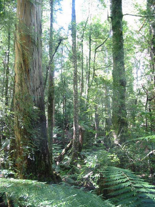
Warm Temperate Rainforest at Martins Creek. Lilly Pilly trees are a dominant canopy species.
Rainforest Habitat
East Gippsland Rainforest generally grows in sheltered south-facing gullies. Warm Temperate Rainforest generally grows from sea level to about 700 metres altitude while Cool Temperate rainforest grows between 600 and 1200 metres elevation.
The image below illustrates the habitat requirements. VRN has overlayed rainforest ecological vegetation class (EVC) maps onto Google Earth imagery. Cool Temperate rainforest is represented by bright green ![]() and can be seen at higher elevations while warm temperate rainforest at lower elevations is light green
and can be seen at higher elevations while warm temperate rainforest at lower elevations is light green![]() .
.
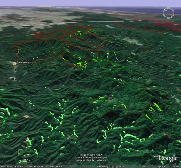
This view to the north east shows rainforest communities that lie south west of the Errinundra National Park (outlined in red)
In some high resolution images from Google Earth you can actually see the individual rainforest communities in the gullies.
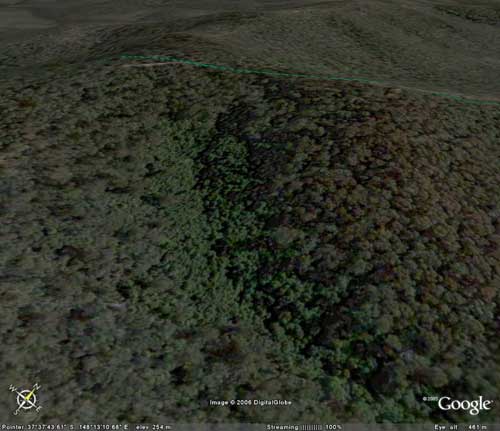
Warm Temperate Rainforest at Rainforest Site Of Significance 36 is the brighter green forest in this sheltered south east facing gully.
How much rainforest is Threatened by clearfell logging?
According to the East Gippsland Forest Management Plan only 34% of rainforest stands in East Gippsland are protected within dedicated reserves.
Any rainforest not in a dedicated reserve is under threat from the impacts of clearfell logging.
The majority of rainforest stands are within production forestry areas (ie. logging areas) where inappropriate rainforest buffers are applied.
Google Earth rainforest overlay
So what does all this rainforest these really look like on the ground? If you do not have means to jump in a car and drive to East Gippsland then next best thing is to use virtual reality!
VRN has created an overlay of Rainforest Ecological Vegetation Class (EVC) for Google Earth. This overlay covers the areas shown on the map below.
The rainforest EVC KMZ files for Google Earth contain 14 individual maps that are give the same coverage as standard 1:50,000 topographic maps. The numbers in red on the map above are the key for each individual Rainforest (EVC) overlay for Google Earth.
Cool Temperate rainforest is represented by bright green ![]() and can be seen at higher elevations while warm temperate rainforest at lower elevations is light green
and can be seen at higher elevations while warm temperate rainforest at lower elevations is light green![]() .
.
Note: Do not overload your computer. See more.
Download all overlays at once or select individual overlays from index map.
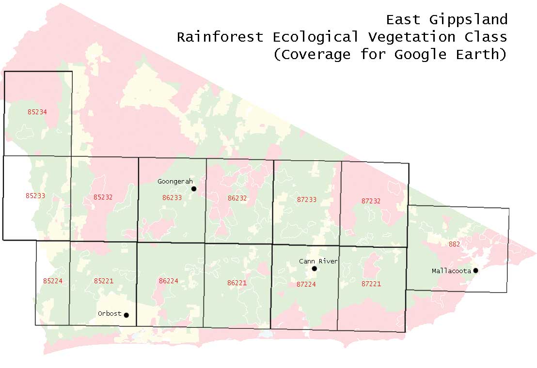
Note:
- If all the rainforest EVC layered maps are turned on, Google Earth may work slowly or be jerky. To avoid this do not have all the layers turned on at once.
- VRN has taken care to align these images as accurately as possible however there may be some misalignment in some places.
Some things you may want to look at in Google Earth
- Fade the layers in and out to reveal the deep gullies these rainforest communities exist in. Where high resolution images are available, see rainforest stands in detail.
The fade bar looks like this and is under the list of GoogleEarth places:
- Notice how the rainforest is generally in cool south face gullies.
- See if you can find the rare dry rainforest
 (khaki color).
Also see for East Gippsland
- Rainforest Sites of Significance (Layer for Google Earth)
- Clearfell logging history and impacts on rainforest (Layer for Google Earth).
- National Parks and reserves boundaries for Google Earth