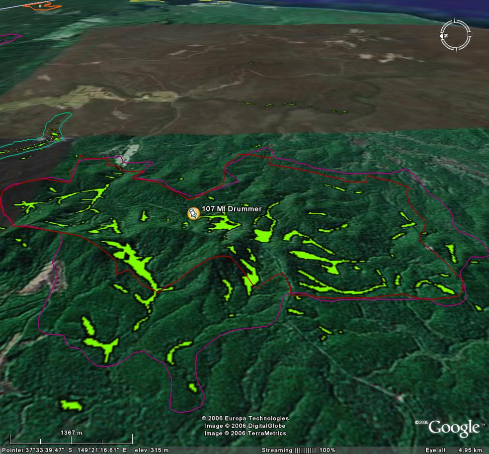
Image description: View looking east shows extensive stands of warm temperate rainforest. Much of this site is within the Mt Drummer National Park (See red line). Recent logging within site (pink area) can be seen.
Lots of endangered species inc Slender tree fern.
Mt Drummer National Park component takes up most of this site. State forest part logged recently.
Public land management zones within RSOS |
||
Approximate total area: 880ha |
|
|
|
% |
ha |
F&F reserves |
0%
|
0
|
SPZ |
4%
|
35.2
|
SMZ |
0%
|
0
|
GMZ |
0.96
|
844.8
|
Private |
0
|
0
|
Area logged |
0.5
|
440
|
The Rainforest EVC (Ecological Vegetation Class) and RSOS boundaries have been overlayed onto Google Earth imagery to produce images that give a three dimensional perspective of the landscape where rainforest communities exist in East Gippsland. (Note: Rainforest EVC colour code is not consistent for all images.)
Image description: View looking east shows extensive stands of warm temperate rainforest. Much of this site is within the Mt Drummer National Park (See red line). Recent logging within site (pink area) can be seen.