Why use overlays in Google Earth to see how much forest has been clearfell logged?
Often the native forest logging industry argues that less than 1% of the forest is clearfell logged every year and after logging the forest "regenerates" (see arguments counteracting this myths). This sounds like not much logging so there is no need for the public to be alarmed or concerned.
However what does the cumulative effect of the clearfell logging look like on the landscape over the years? How often has clearfell logging occurred near or destroy rainforest? How much mature/old growth forest remains to be logged?
The image below is a raw image from Google Earth where you can actually pick out areas that were recently clearfell logged(less than 12months) as pinkish areas. However as vegetation re-grows over the logged areas, the ground greens over and disappears into the background of the satellite image.
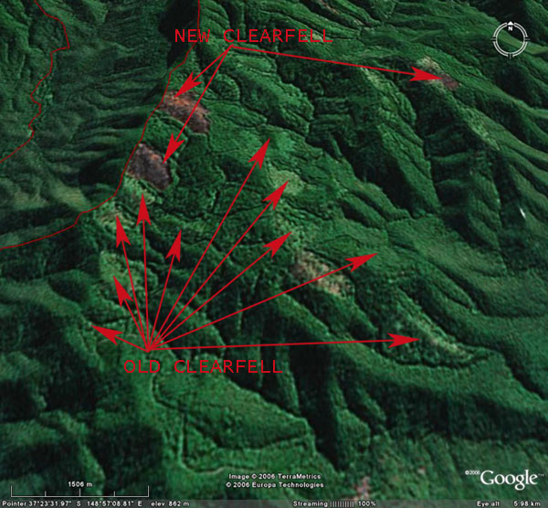 Raw image from Google Earth showing recent clearfell logging as pinkish areas. Old clearfell logging is hard to see.
Below is an image of a recent area clearfell logged and burnt. There is almost no green vegetation left. Satellite images such as those used in Google Earth represent such areas as pink patches in low res images.
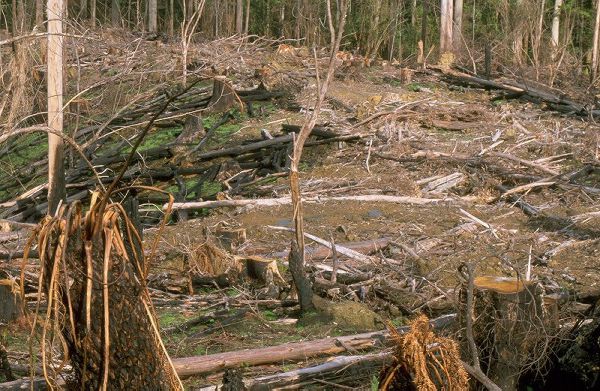 Fresh clearfell logging in the Otways 2001. All the original vegetation has been destroyed and the soil left disturbed and exposed.
A year and more after logging, vegetation like grass, weeds and small tree saplings quickly cover the logged area as shown in the example image below. The carpet of green acts like camouflage making it more difficult to see the cumulative extent of clearfell logging from satellite images.
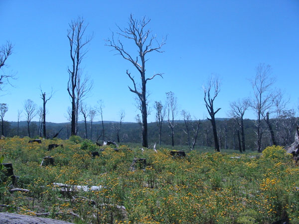 Logging at East Errinundra done in 2001. Photo taken in 2005.
So VRN has created an overlay for Google Earth to make transparent the past 20 to 35 years of clearfell logging history in Victoria.
When these logging history overlays are activated in Google Earth, the cumulative clearfell logging effect can be revealed, as shown in the image below. The pink areas was old growth forest that was clearfell logged from the late 1980's to June 2004. The dull green areas are young even aged forests that were clearfell logged from the early 1970's to the late 1980's (East Gippsland only).
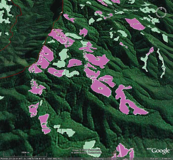 Cumulative affect of clearfell logging south east of the Errinundra National Park (red line).