Central Highlands Rainforest
On this page:
Rainforest Types
Rainforest Habitat
How much rainforest is threatened by clearfell logging?
Google Earth rainforest overlay for the Central Highlands
Rainforest Types
Both Cool Temperate and Mixed Rainforest grow in the Central Highlands.
Officially the Cool Temperate Rainforest ecological vegetation class (EVC) covers approximately 13,000 ha of the public land (less than 1%). In the Central Highlands myrtle beech is the dominant canopy species but often grows in combination with southern Sassafrass.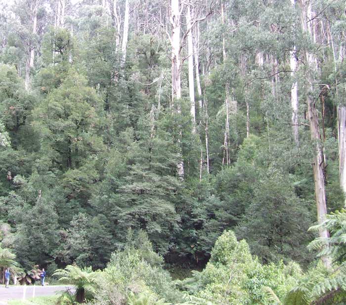
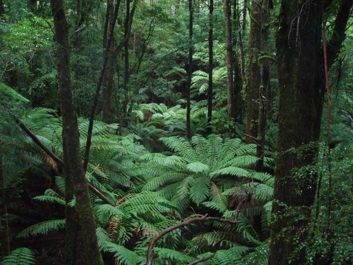
Cool Temperate rainforest from the road in the Cement Creek rainforest Site of State Significance.
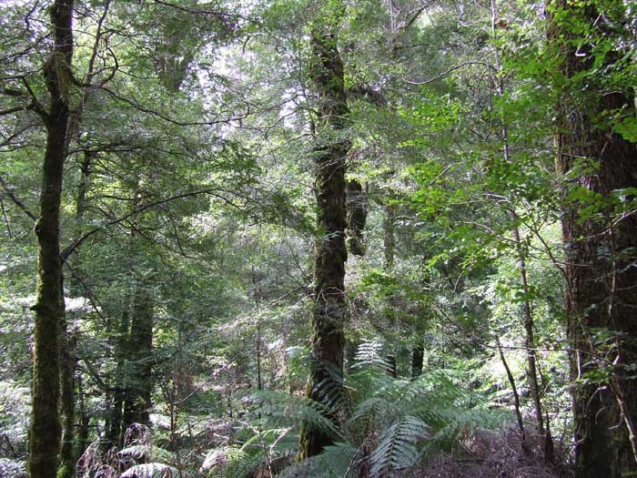
Stand of Cool temperate rainforest dominated by myrtle beech in the Acheron Rainforest Site on National Significance.
Sassafrass (two trees from the left) growing in conjunction with myrtle beech in the Acheron.
Cool temperate rainforest at the Saxton State Rainforest Site of Significance on the southern end of Mt Baw Baw. This rainforest is threatened by logging practices.
In addition to the above, Mixed rainforest (or mixed forest) is a rainforest classification where eucalypt forest grows in combination with myrtle beech. The classification of mixed rainforest is controversial as the Victorian Government doesn't officially acknowledge it as rainforest, so it is available for logging.
No one knows how much mixed rainforest exists in the Central Highlands as it has never been mapped. (See more)
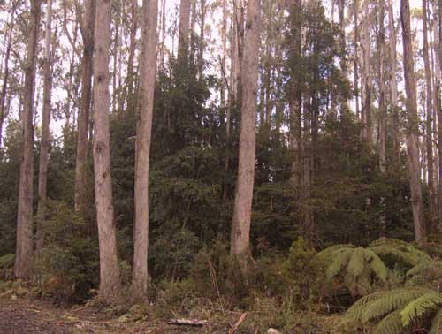
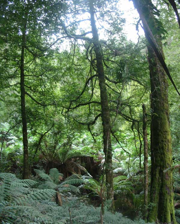
An understorey of myrtle beech amongst eucalypt characterises mixed rainforest(mixed forest)
Rainforest Habitat
Rainforest generally grows in sheltered south-facing gullies. Cool Temperate rainforest grows between 600 and 1200 metres elevation.
The image below illustrates the habitat requirements. VRN has overlayed rainforest ecological vegetation class (EVC) maps onto Google Earth imagery. Cool Temperate rainforest is represented by bright green.
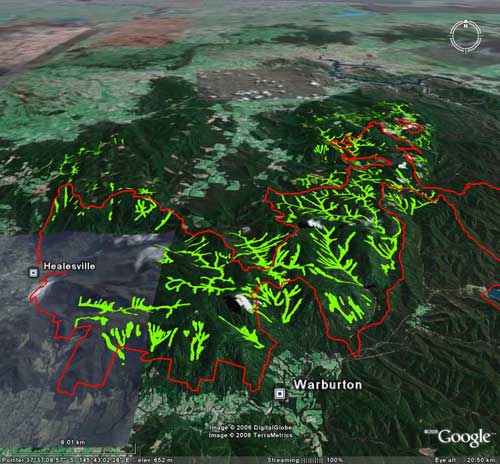
Download hi res pdf of this image.
In this image the red line marks the approximate boundary of the Yarra Ranges National Park. Bright green represents the extensive stands of cool temperate rainforest growing predominately on south facing slopes.
In some high resolution images from Google Earth you can actually see the individual rainforest communities in the gullies. Rainforest tends to grow at high altitudes in sheltered south facing gullies.
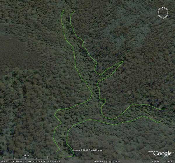
Myrtle beech trees, the primary canopy species for Cool Temperate rainforest in the Central Highlands, can be clearly seen inside the green line. This image is from the south west side of Mt Baw Baw.
How much rainforest is Threatened by clearfell logging?
According to the Central Highlands Regional Forest Agreement only 43.84% of rainforest stands in the Central Highlands are protected within dedicated reserves. Cool Temperate mixed rainforest has never assessed or mapped (see more).
Any rainforest that is not within dedicated reserve is under threat from the impacts of clearfell logging.
The majority of rainforest stands are within production forestry areas (ie. logging areas) where inappropriate rainforest buffers are applied.
Myrtle Wilt
The rainforest Myrtle Beech trees in the Central Highlands are vulnerable to a natural die back disease called Myrtle Wilt which can be elevated to epidemic levels by logging practices.
To find out more detail about myrtle wilt and logging see a detailed explanation of myrtle wilt on the Otway Ranges Environment Network website.
The image below shows a myrtle beech tree in the Melbourne Water supply catchments of Mt Baw Baw that has been wounded by logging machinery and subsequently died from myrtle wilt.
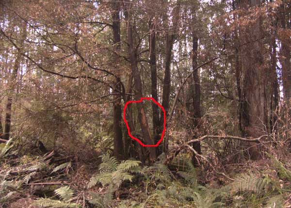
This myrtle beech tree has been hit by logging machinery(red circle) and subsequently died from myrtle wilt.
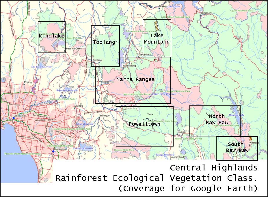
Google Earth rainforest overlay
VRN has created a cool temperate rainforest overlay for Google Earth. This overlay covers the areas shown on the map below.
The rainforest EVC KMZ files for Google Earth contain 7 individual maps. Cool Temperate rainforest is represented by bright green ![]() .
.
Download all rainforest overlays  or click on the index map below.